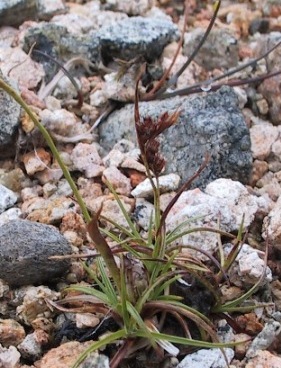
Collecting altitudinal data was popular in Victorian times, cumulating in Wilson’s work from the 1920s and 1930s, which was collected together and slightly updated posthumously (Wilson 1956).
For the New Atlas (Preston et al., 2002) we used this as a base, and supplemented it with any recent data available, adding the following background note, which we here reproduce in its entirety.
“The main sources of information on the altitude ranges of British and Irish plants are Wilson (1956), who compiled records for England, Wales, Scotland and Ireland, and Halliday (1997), who provided altitudinal ranges for all species in Cumbria. In compiling the data for the New Atlas, these were supplemented by information in Stewart et al. (1994), Preston & Croft (1997) and Wigginton (1999), and many from the Vascular Plant Database. Wilson (1956) compiled his altitudinal data from many published sources, dating from 1847 up to his death in 1949, and from his own observations. His work was first published, in parts, from 1931 onwards. Many of the altitudes cited in Wilson (1956) were derived from 19th century sources and are couched only in general terms, such as “3200 ft in the Scottish Highlands” or “2000 ft in Scotland”. If these remain the highest record we have supplemented them, where possible, by a precise figure from a lower site. From 1949 until 1994 the study of altitudinal limits enjoyed little popularity, although McVean & Ratcliffe (1962) recorded the heights of their quadrats. There is much more work to be done to establish the true altitudinal limits of plants in Britain and Ireland; even a few days spent systematically collecting data in the field can yield substantial results (cf. Preston & Pearman, 1998).”
Since that Atlas we have collected over 1000 new records or corrections. Most of these are new, and quite a few came from the excellent work undertaken through SNH on their Site Condition monitoring. In this latest compilation we have also gone back to most of Wilson’s sources and amplified where we can. Wilson included data on highest records for each country (England, Scotland, Wales, Ireland) but we have only made a start on this, and only where recent data exists. For most species there is nothing better available than the data included by him. This gives an uneven picture in the current listing, but it will improve as more people become keen.
By and large the details given in the latest Atlas - Plant Atlas 2020 (Stroh et al., 2023) - mirror those given in this compilation although recent work, such as the high altitude of trees in Scotland (see Watts, 2023) are new. Further analysis of the data in the BSBI’s Distribution database (DDb), hinted at in the Plant Atlas 2020, could well produce many new limits for species.
Download the spreadsheet
Whilst we have given, with much hesitation, atypical sites where species have been sown or dumped, we have marked these as alien, and retained the highest ‘native’ site.
Please try and add or improve them – absence of a species means that there are no records over 310 m (1000 feet). Even a quick trip to the top of Ben Macdui in 2010, in thick mist, resulted in about 20 new records or confirmation of very old records. Work on the Ben Nevis in the last few years has been especially productive. For many of the alpine species we have tried to find lowest altitudes, a more difficult task. Again, any records for this aspect are welcomed. As an example of what might be done, John Crellin has recently reviewed all the records for Brecon and added around 100 new altitudinal records for both Britain & Ireland or for Wales. Granted this is for a southerly upland county, with lots of limestone, but a real achievement!
For all records we require at least the following details: altitude, 6 figure grid reference, site, vice county, date and recorder, differentiating between field and literature records. By all means use a GPS, but, unless yours is miles better than those we have seen, please check it against the contours on a map if at all possible, rounding down to the next 5 m below. Please bear in mind that this is a working document. In particular there are a few queries, marked as such, any help would be appreciated.
Please send any records to:
Mr. D.A. Pearman, Algiers, Feock, Truro, Cornwall, TR3 6RA
We would particularly like to acknowledge the records and help from:
Arthur Chater, John Crellin, Viv Halcrow, John Hawksford, Jim McIntosh, Alex Lockton, Theo Loizou, Jeremy Roberts, Gordon Rothero, Ian Strachan, Dan Watson, Sarah Watts and Sarah Whild.

References
Halliday, G. 1997. A Flora of Cumbria. Centre for North-West Regional Studies, University of Lancaster.
McVean. D.N. & Ratcliffe, D.A. 1962. Plant communities of the Scottish Highlands. Monographs of the Nature Conservancy Council No. 1. HMSO, London.
Preston, C.D. & Croft, J.M. 1997. Aquatic Plants in Britain and Ireland. Harley Books, Colchester.
Preston, C.D. & Pearman, D.A. 1998. Aquatic plants at high altitudes in the Breadalbane mountains (V.C. 88), Scotland. Watsonia 22, 187-190.
Preston, C.D., Pearman, D.A. & Dines, T.D. 2002. New Atlas of the British and Irish Flora. Oxford University Press.
Stewart, A., Pearman, D.A., & Preston, C.D. 1994. Scarce Plants in Britain. JNCC, Peterborough.
Watts, S.H. 2023. High mountain trees altitudinal records recently broken for eleven different tree species in Britain. British and Irish Botany 5(2): 167-179.
Wigginton, M.J. 1999. British Red Data Books 1: Vascular plants (3rd ed.). Joint Nature Conservation Committee, Peterborough.
Wilson, A. 1956. The altitudinal range of British plants, 2nd ed. T. Buncle & Co., Arbroath.
Citation
If you make use of this altitude data in a paper or publication, you could cite it as follows:
Pearman, D.A. 2023. BSBI projects: Altitudinal Limits. Available at: www.bsbi.org/altitudes